


BUFFALO, N.Y. (WKBW) — As August comes to a close and the official temperature at the Buffalo Airport reached 81 degrees on August 31st 2021, the average temperature for the month of August topped out at 75.7 degrees. By a tenth of a degree, 2021 now takes over as the hottest August on record. August 2016 averaged 75.6 degrees.
There were only a hand full of days with high temperatures below average, and three of them were at the start of the month.
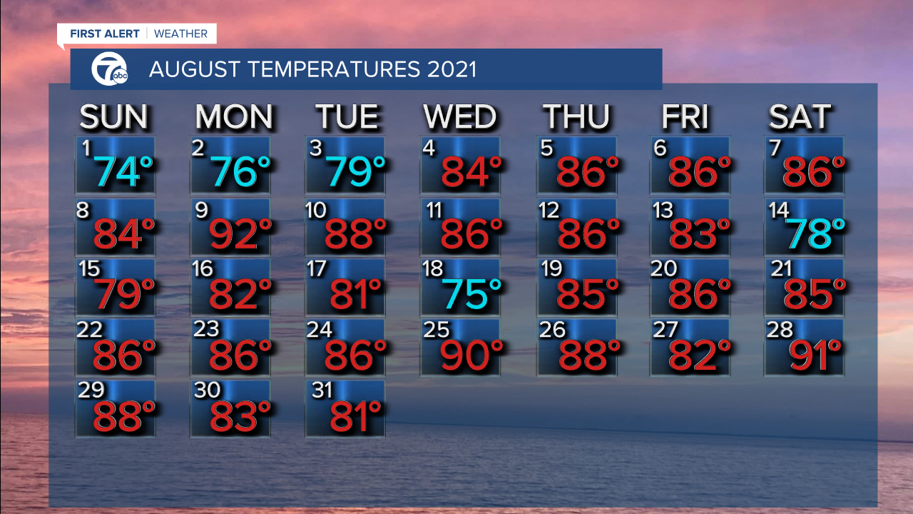
We also had the two longest stretches of 80-degree weather in the month of August. We ended August with 13 straight days of temperatures above 80, and that included two 90-degree days! The previous stretch was earlier this month and included another 90-degree day.

We also tied the warmest Lake Erie water temperature has ever been on the 29th and 30th at 77 degrees. It shares the record with 2016 and 1959.

As the meteorological summer comes to an end (June, July and August), let's look back!
June had an average temperature of 71.3 degrees, this was enough to solidify a finish in the top five for warmest Junes on record. It also had a deficit of rainfall at 1.6" which put the year under by 6.84".
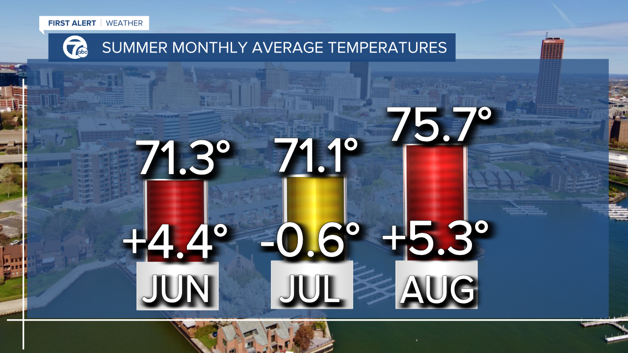
If you recall, our lawns weren't very green! Then July rolled in and we took a step back in the temperature department but the precipitation was off the charts. The month finished at 7.49" and put July 2021 precipitation in the #3 spot for wettest on record. August finished almost a half-inch above average for precipitation which as a whole keeps the summer as a surplus over three inches.
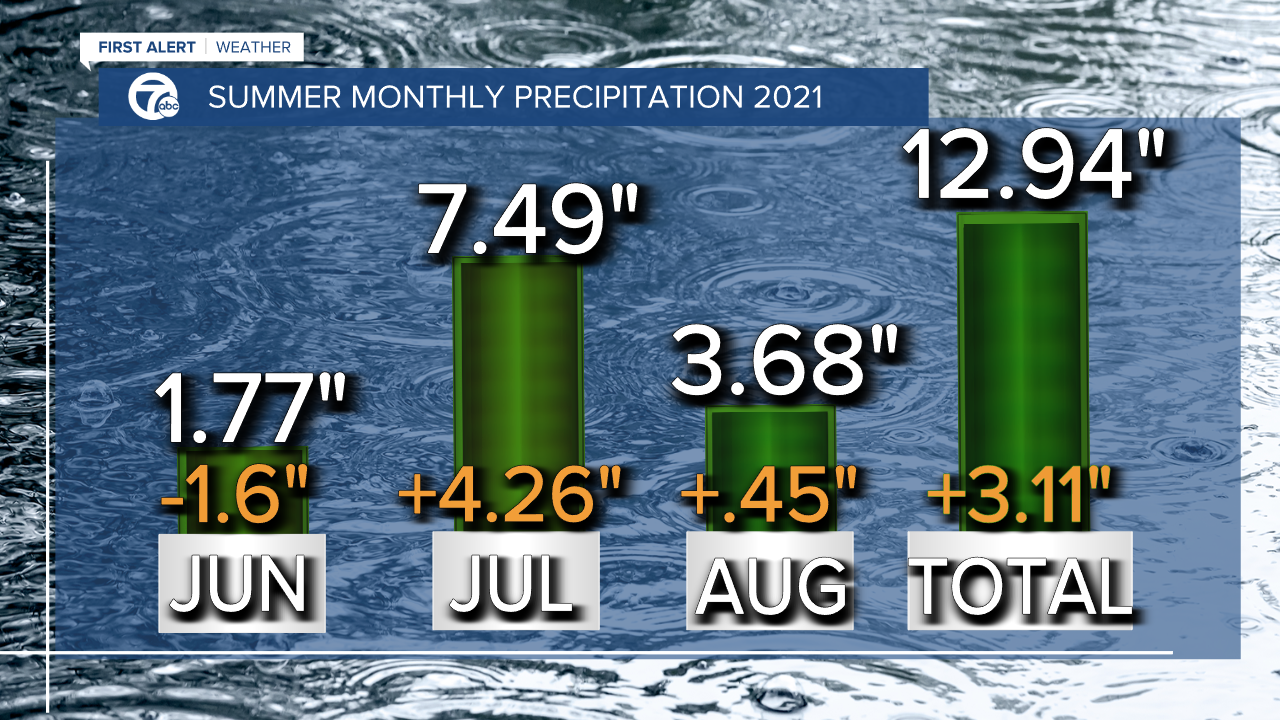
If you look at the year as a whole, the total precipitation is up to 23.17" but falls short of the average amount by 2.13." In the grand scheme of things, this deficit doesn't play a big role since the last couple of months helped WNY watershed and took us out of any drought.
To check out the beginning of September's forecast click here for the 7 First Alert Forecast.
