


It's been seven months since Buffalo has received measurable snowfall with a few inches at the end of April!
While the Buffalo Airport will still be a minimal player in the wintry weather ahead, it'll be a good time to find the snow brush, prime the snow blowers and activate winter drive skills.
Here's what to expect:
SATURDAY:
7AM:
Rain/snow lake showers north and south of Buffalo.
Winds become more westerly and temps even drop a couple degrees through the noon hour.
As the lake band moves over Buffalo on its way to S.Erie county, it'll spend a few hours near the city and towards Batavia.
While downtown and the lakeshore remain as rain, inland can see a bit of a mix and more flakes toward Batavia.
No accumulation is expected.

SATURDAY 1PM- 3AM SUNDAY
Lake rain/snow settles south of Buffalo, with snow showers for the deeper hills in S.Erie county, Wyoming county and the S.Tier.
Remember the closer to lake you are, the better rain chance than snow. Minor accumulation, an inch or two

3AM-8AM SUNDAY
Lake band on the move back north and impacting Buffalo during the morning with rain/snow. Minor accumulation for south of Buffalo.
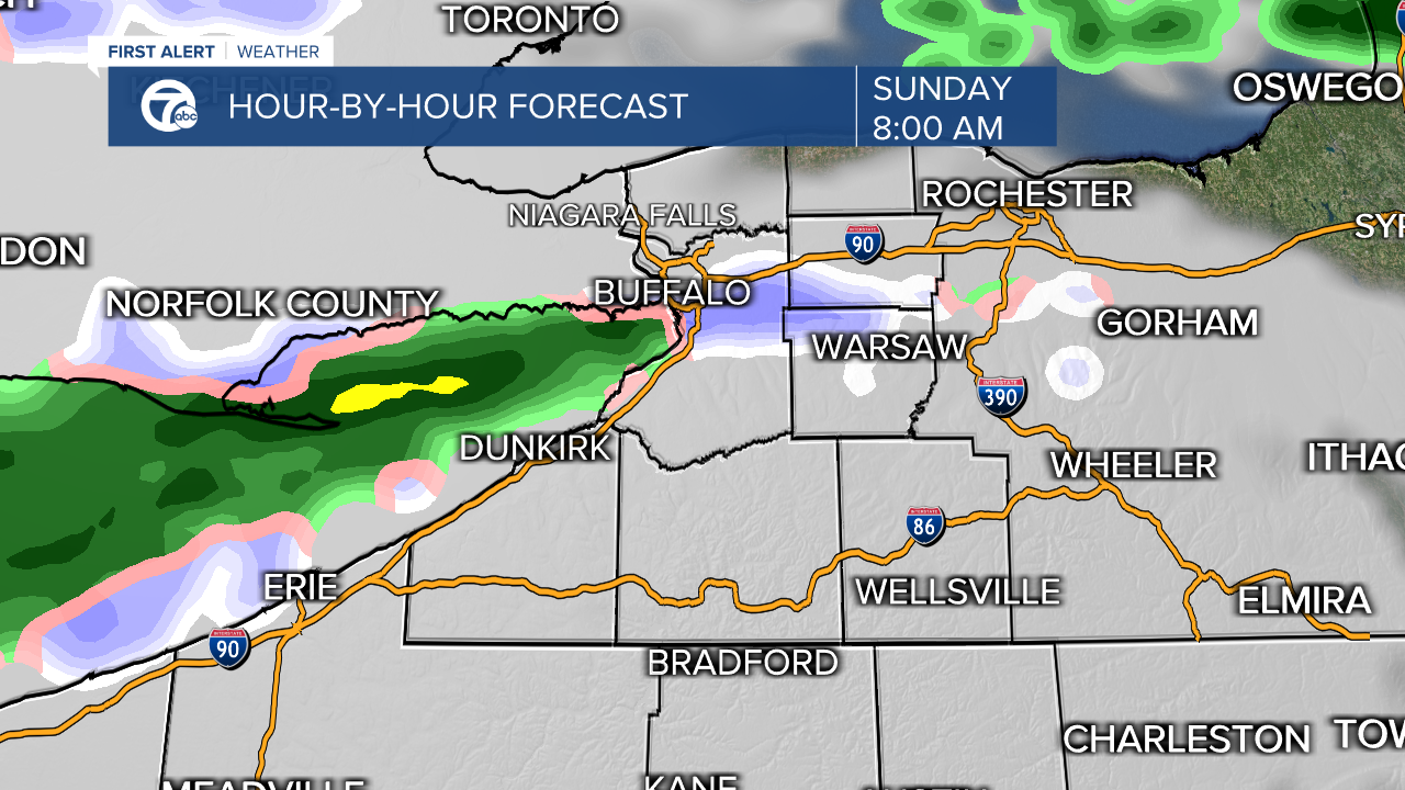
8AM-NOON
Buffalo impacted by lake rain/snow, little accumulation.

NOON-11PM
Next round as a more generalized mix moves across WNY but as temperatures warm, more rain can mix in limiting snow.

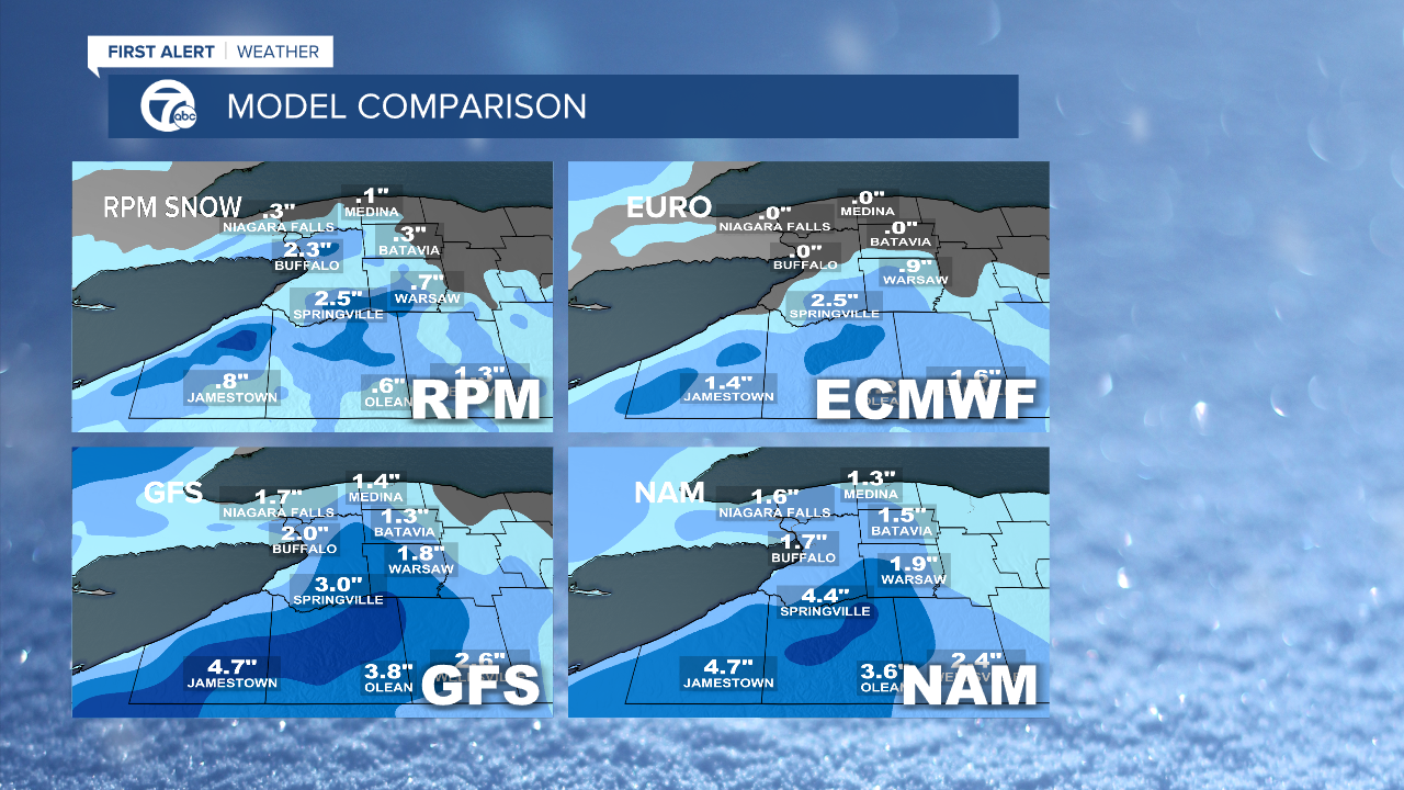
Below is model comparisons through Sunday and you can see there are different ideas of what snow will fall for Buffalo but in general, expect an inch or two and not for it to last on the ground long. The S.Tier generally picks up 2-4" with additional amounts into the evening Sunday and Monday.
11PM-7AM MONDAY
Limited rain showers near the lakeshore and few snow showers for the S.Tier. As winds shift to NW by Monday morning any lake effect becomes limited to the S.Tier with additional accumulations.

For those of you wondering if this is a late or early 1st snow, here are some stats:
November 3rd was the Buffalo Airport's official first trace of snow for the season, about a week delayed.
November 13th-14th will likely be the first .1" and 1" which makes it a pretty average start to the snowy season.
For the remainder of your 7 First Alert Forecast and to see the 50s again, click the link!
