
High Wind WARNING until 8pm Monday for Southern Erie, Chautauqua counties for southerly wind gusts to 60mph+
The worst winds will be across the Chautauqua Ridge and along the Lake Erie shoreline. Power outages are possible.
Wind ADVISORY for Northern Erie, Niagara, Orleans, Genesee, Wyoming, Allegany, Cattaraugus counties until 8pm Monday and for McKean, Potter counties until 11am Monday for southerly wind gusts to 50mph+ Power outages are possible.
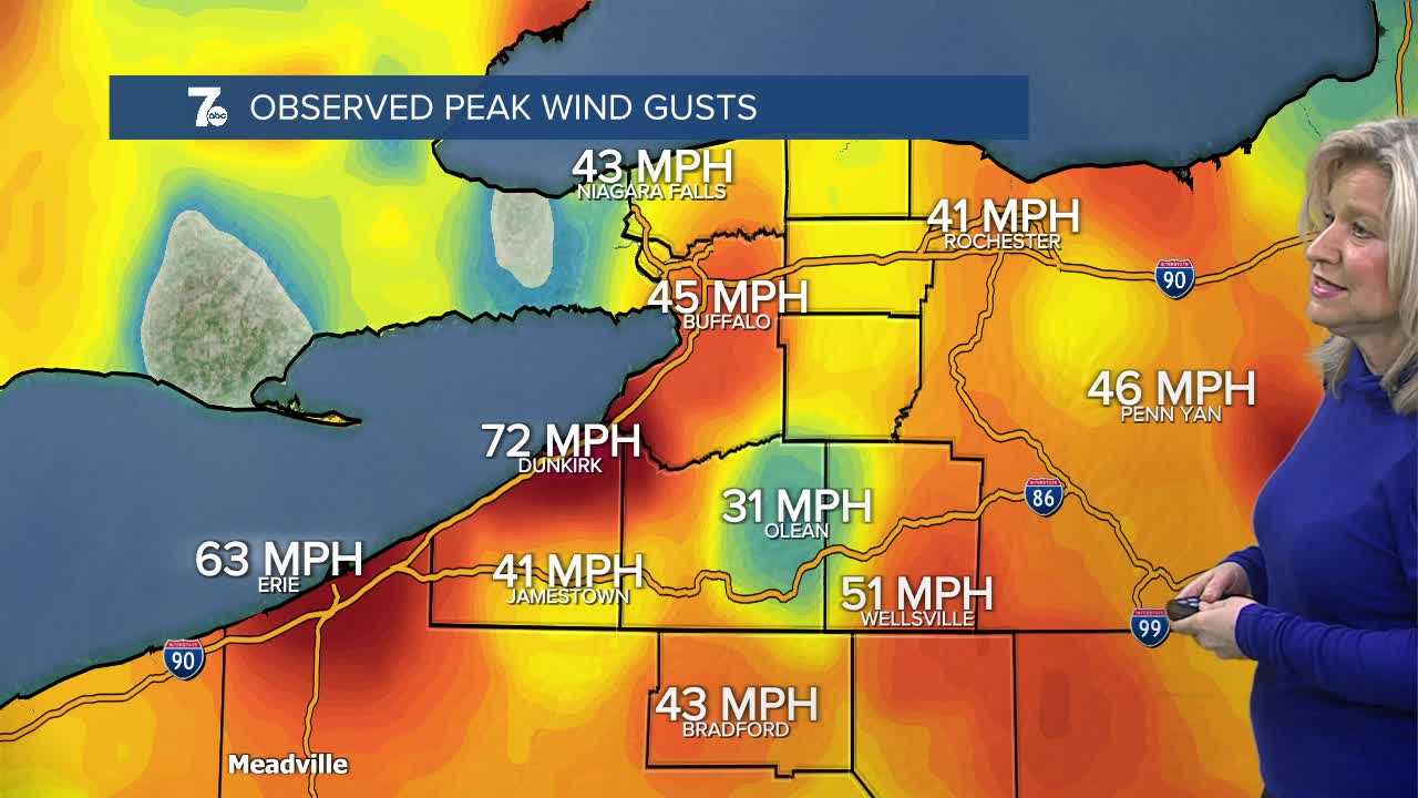
Strong to high winds are quickly developing across WNY this Sunday evening. Strongest gusts from 45-60mph+ are expected along the Chautauqua Ridge and Lake Erie shorelines, but are possible all across WNY from this evening into Monday. Scattered power outages are possible. Travel will be difficult for high profile vehicles, especially. Be sure to have flashlights handy and keep your cell phones charged.
Temperatures will drop nearly 20 degrees in a 6-hour window afternoon from the upper 50s to the upper 30s toward evening as a powerful cold front crosses the region. The Storm Prediction Center includes WNY in a risk for damaging thunderstorms Monday afternoon mainly south and east of Buffalo, where there is an outside chance of a tornado, especially in SE Wyoming, Allegany, Potter, and eastern McKean counties.
SUNDAY
EVENING: High winds, partly cloudy, low 50s
MONDAY
MORNING: Windy, mid 40s.
AFTERNOON: Thunderstorms, rain to snow, windy near 60.
TUESDAY
MORNING: Colder, near 20.
AFTERNOON: Lake flakes, mid 20s.
