
BUFFALO, N.Y. (WKBW) — The combination of rainfall and accelerated snowmelt from Saturday's warm temps will promote rising water on area tributaries this week. Expect increasing sunshine today with highs in the upper 40s and gusty west winds to 40mph.
FLOOD WARNING for Tonawanda Creek at Batavia CANCELLED Sunday evening.
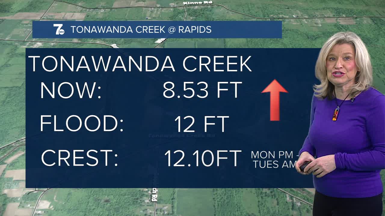
FLOOD WARNING for Tonawanda Creek at Rapids from Monday evening through Tuesday morning. Minor flooding is anticipated. The river is expected to rise above flood stage Monday afternoon or evening to a crest of 12.1 feet Monday evening. It will then fall below flood stage early Tuesday morning. At 12.0 feet, Flood stage, lowland flooding of farm areas along Tonawanda Creek between Rapids and the Tonawanda Indian Reservation. Flooding may impact Fletcher, Burdick, Kelkenberg, and Tonawanda Creek Roads.
Be sure to move belongings to higher ground, and never drive across flooded roadways.
SUNDAY
EVENING: Clearing skies, breezy, near 40
MONDAY
MORNING: Partly cloudy, near 40.
AFTERNOON: Mostly sunny, breezy low 60s.
TUESDAY
MORNING: Mostly cloudy, mid 40s.
AFTERNOON: Showers develop, near 60.
WEDNESDAY
MORNING: Rain & T-Storms, near 50.
AFTERNOON: Rain & T-Storms , near 60.
