
BUFFALO, N.Y. (WKBW) — A multi-hazard storm will have significant impacts on Western New York starting Monday. After a round of strong, damaging winds, it turns sharply colder, with a prolonged period of potentially heavy lake effect snow, that lasts into Friday.
WINTER STORM WARNING for Wyoming, Chautauqua, Cattaraugus, and southern Erie Counties from 1pm Monday to 1am Friday.
FLOOD WATCH for most of Western New York Sunday afternoon through Monday afternoon for widespread rainfall amounts of 1 to 2 inches
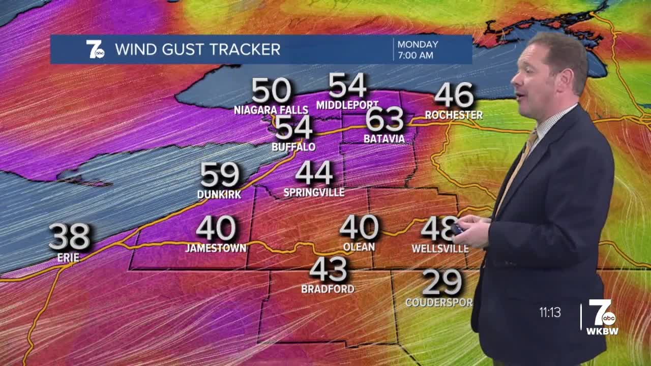
HIGH WIND WARNING from late Sunday night into Monday night for Erie, Niagara, Orleans, Genesee, Wyoming, and Chautauqua Counties, for potential wind gusts of 60 to 65 mph, especially along the Chautauqua ridge.
LAKESHORE FLOOD WARNING in effect from late Sunday night into Monday night for the Lake Erie shore of Erie and Chautauqua counties.
A rather active weather pattern is shaping up heading into the new week. One area of Low pressure will track towards Western New York on Sunday. The path that it carves means more of a wet scenario than a wintry one. The cold front that accompanies it will not only cause a wild temperature fluctuation, but also some strong winds on Monday. Gusts may reach 60 to 65 mph.
SUNDAY:
MORNING: Cloudy, mid 30s
AFTERNOON: Rain, lower 40s
MONDAY
MORNING: Rain & snow, 40s
AFTERNOON: Windy, snow, mid 40s and falling
TUESDAY
MORNING: Lake snow, low 20s
AFTERNOON: Lake snow, mid 20s
