
BUFFALO, N.Y. (WKBW) — A weak area of high pressure builds in for Friday, bringing dry conditions to end the week. The next system arrives on Saturday with rain late in the day. Expect temperatures to rise above average on Saturday into the 50s before rain arrives for the afternoon. It'll remain wet for the rest of the evening, even heavy at times, plan according for your Saturday afternoon/evening plans. The rain will change to snow as temperatures drop on Sunday. Temperatures fall into the 30s by Sunday afternoon with strong gusty winds.
OVERNIGHT: Mostly cloudy and cool, mid 30s.
FRIDAY
MORNING: Mostly cloudy, low 30s.
AFTERNOON: Mostly cloudy, upper 40s.
SATURDAY
MORNING: Mostly cloudy, low 30s.
AFTERNOON: Rain showers, mid 50s.
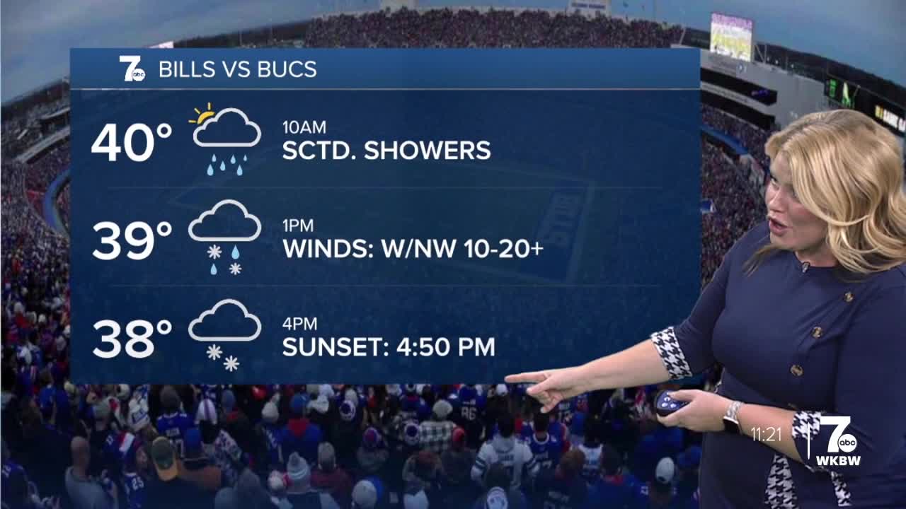
SUNDAY
MORNING: Rain showers, upper 30s.
AFTERNOON: Rain and snow, near 40.
