
Winter Storm Warning through Wednesday afternoon for N. Erie and Genesee Counties. Snowfall rates of up to 1" per hour, winds gusting between 35-40mph will create blowing and drifting snow and near whiteout conditions at times within lake snow.
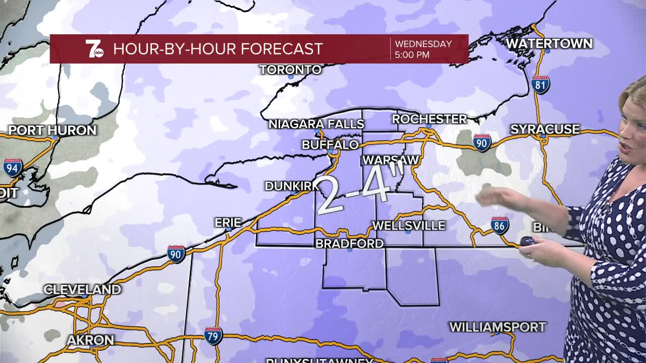
Lake effect snow is on the move headed northward, to impact Metro Buffalo through the evening with 2-4" of snow possible with snowfall rates between .5"-1" per hour.
Be prepared for varying road conditions from gusty winds, creating blowing and drifting snow to lowered visibility within lake effect snow.
An area wide light snow is likely on Wednesday. Another 2 to 4 inches is possible from a broad area of Low pressure. More arctic air follows into the weekend.
WEDNESDAY
MORNING: Snow showers, near 10.
AFTERNOON: Snow showers, near 30.
THURSDAY
MORNING: Snow showers, near 20.
AFTERNOON: Snow showers, upper 20s.
FRIDAY
MORNING: Snow showers, near 10.
AFTERNOON: Snow showers, near 15.
