
BUFFALO, N.Y. (WKBW) — What a beautiful day by early January standards in Buffalo, with temperatures making their way into the lower 50s. Combine that with sunshine, a precious commodity in this part of the world during this time of the year, and not too much in the way of a breeze, and it made it feel real nice to be outdoors!
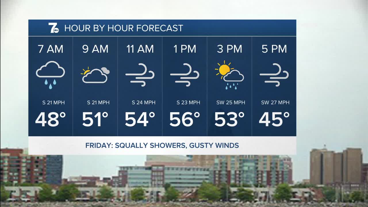
Clouds, winds, and temperatures will increase overnight. Expect waves of wetness to arrive Friday morning, along with some rather gusty winds. Gusts of 40 to 50 mph are possible. High temperatures wil be close to 60 in a few spots early in the afternoon! The time frame to watch for some of the stronger wind gusts will be midday and early afternoon. It won't be a rain soaked day, as the showers should end into the afternoon with dry conditions remaining until Saturday afternoon.
Another round of gusty winds are possible Saturday night into Sunday morning, as a cold front sweeps across Western New York, knocking temperatures back to levels more typical of this time of year. We'll be back into the 30s for highs on Sunday. Back to "reality"
THURSDAY
EVENING: Increasing clouds, temps rise through the 40s
FRIDAY
MORNING: Rain, near 50.
AFTERNOON: Windy, mid 50s.
SATURDAY
MORNING: Mostly cloudy, mid 30s.
AFTERNOON: Rain, near 40.
SUNDAY
MORNING: Snow showers, near 30.
AFTERNOON: Snow showers, low 30s.
MONDAY
MORNING: Snow showers, low 20s.
AFTERNOON: Windy, mid 30s.
