
Lake Effect Snow Warning until 4 a.m. Friday for Chautauqua, Cattaraugus, and Southern Erie counties.
Winter Weather Advisory until 4 a.m. Friday for Wyoming, and Allegany Counties.
Everyone is cold with lows in the teens. Where snow has fallen, breezy conditions will cause blowing and drifting snow.
Friday features sunshine and temperatures closer to the freezing mark! The next shot of snow showers comes with a lake response late Friday evening from southwest winds - this would impact Metro Buffalo.
Everyone gets a couple inches of snow on Saturday from a quick moving system with some left over snow showers and colder temperatures Sunday with highs in the teens.
EVENING: lake snow south of Buffalo, 20s.
OVERNIGHT: Lake snow ending south. Teens
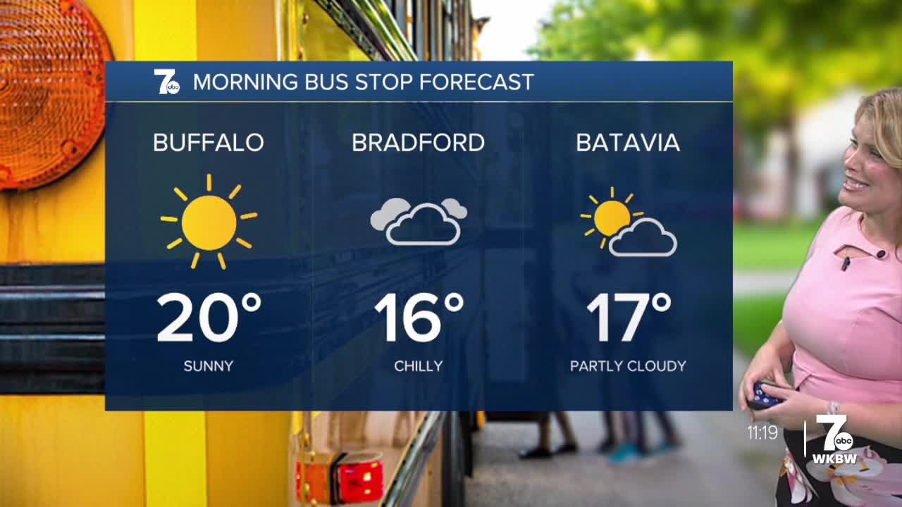
FRIDAY
MORNING: Mostly cloudy, teens.
AFTERNOON: Partly sunny, near 30.
SATURDAY
MORNING: Snow showers, low 20s.
AFTERNOON: Snow showers, upper 20s.
SUNDAY
MORNING: Snow, near 10.
AFTERNOON: Mostly cloudy, near 20.
