
Winter Weather Advisory for Chautauqua Co. until 1pm on Monday
Winter Weather Advisory for Orleans and Niagara counties until 7am on Monday
Buffalo officially recorded its first measurable snowfall of the season on Sunday, with 0.9" falling at the airport by late afternoon.
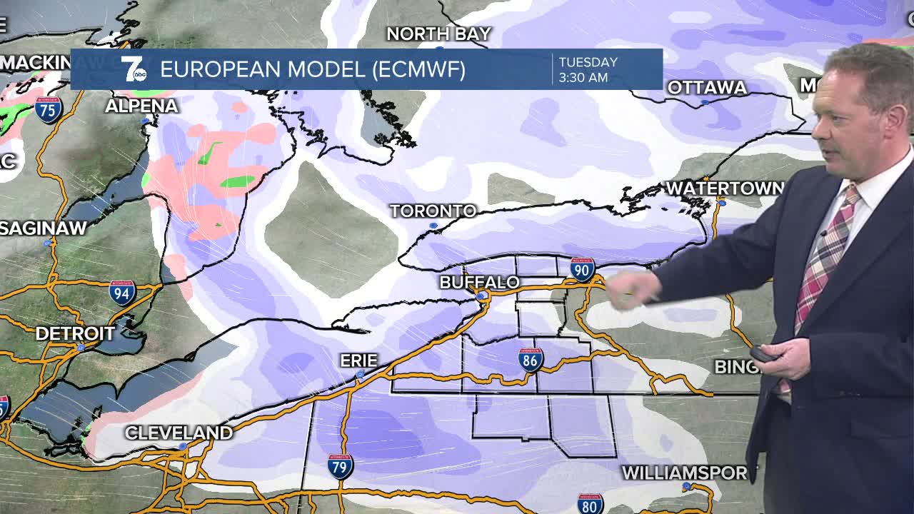
Flurries and limited areas of lake snow will continue tonight into Monday morning. More organized bands of lake snow will develop off of both Lake Erie and Ontario Monday night into Tuesday. Ski country will take the "lion's share" of the snow with the potential of a solid half of a foot on our hilltops by the end of Tuesday.
The lake effect pattern should ease by the time we get into the middle of the week with temperature gradually moderating.
SUNDAY
EVENING/OVERNIGHT: Lake flakes, 1-4" for some, 30
MONDAY
MORNING: Wet flakes, upper 20s to 30
AFTERNOON: Mostly cloudy, flurries, cold, mid 30s
TUESDAY
MORNING: Showers of rain & wet snow, mid 30s
AFTERNOON: Showers of rain & wet snow, 40
WEDNESDAY
MORNING: Cloudy, a flurry or sprinkle, upper 30s
AFTERNOON: Showers, lower 40s
