


The winter 2022-2023 season is upon us and one thing is for sure, La Niña is still in play. This year is the third La Niña season in a row, which has happened two other times since records began in the 1950s (once in the early 70s and the other in the late 90s).
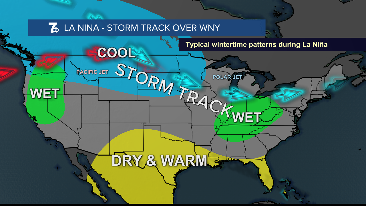
Typically in the La Niña set up, storms track from the pacific northwest to the great lakes and it tends to be warm and dry through the south central United States. With the polar jet remaining further north, less cold intrusions make it into the center of the nation. More storm systems may end up over the great lakes with the Polar Jet remaining at higher latitudes.
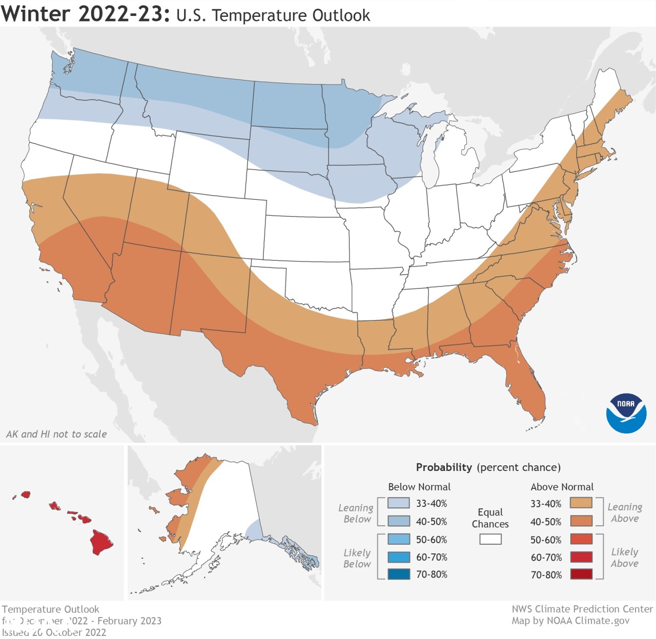
The Climate Prediction Center posted their winter outlook for the 2022-2023 season and it places WNY in the equal chances to have above average temperatures or below average temperatures.
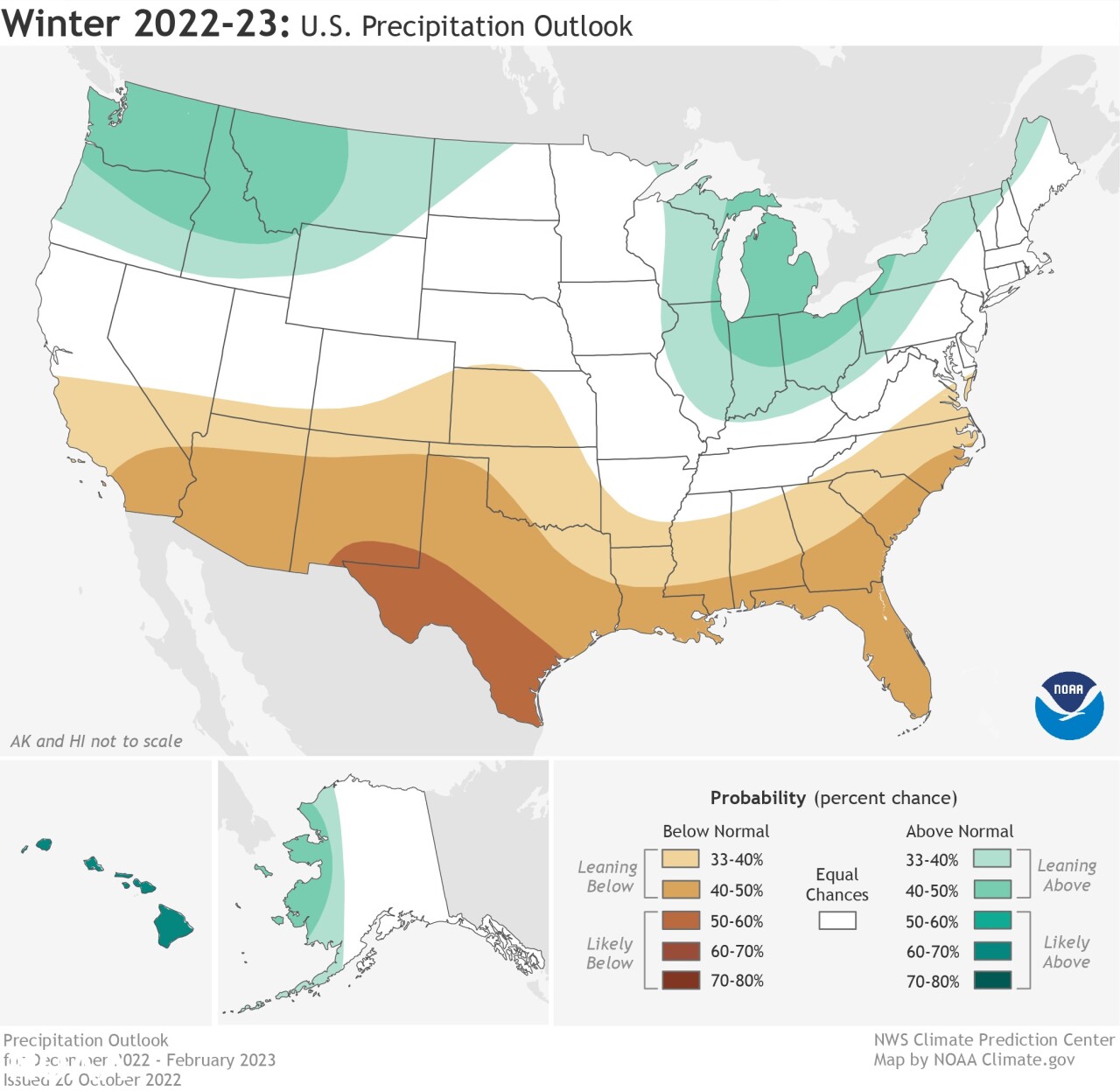
The precipitation outlook has a higher probability that the WNY portion of the Great Lakes will have above average precipitation, this however does not predict whether that is in the form of frozen or liquid precipitation.
However, some of the data below showing the last two La Niña years here in WNY is anything but a sure sign of what's to come in this third La Niña year.

Snowfall from last year, 2021-2022 season, December came in nearly 20" below normal, then January fully shattered normal levels with doubling the average amount of snow at over 50"
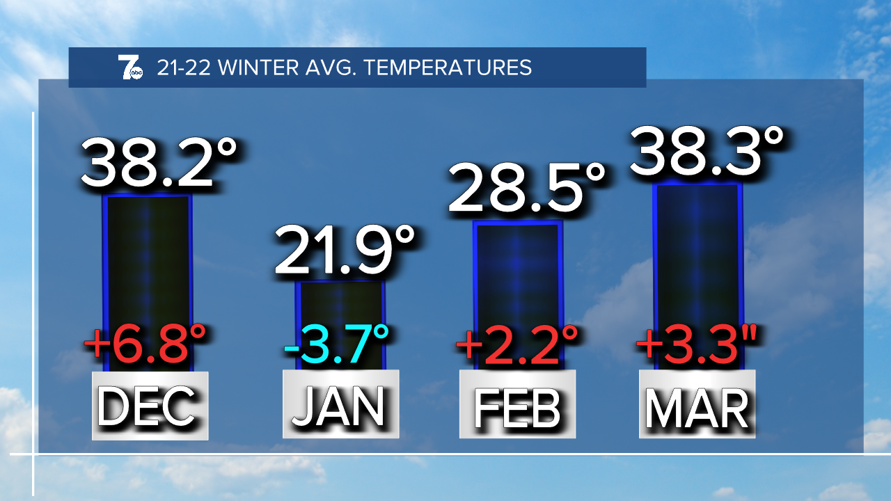
As for the temperatures last year, nearly every month was above normal by a few to several degrees. January, the only month to come in below average, was also the highest amount of snow.

Then you take into consideration the year prior, 2020-2021 winter snowfall. December and January were the opposite of last year. December had a surplus and January was well below average. February is about 5" more than last year and March ended below average again.

Now, with the temperatures, December was above average but also still had above normal snowfall totals, the only other month that ended with above average snowfall was February when the temperatures were below average.
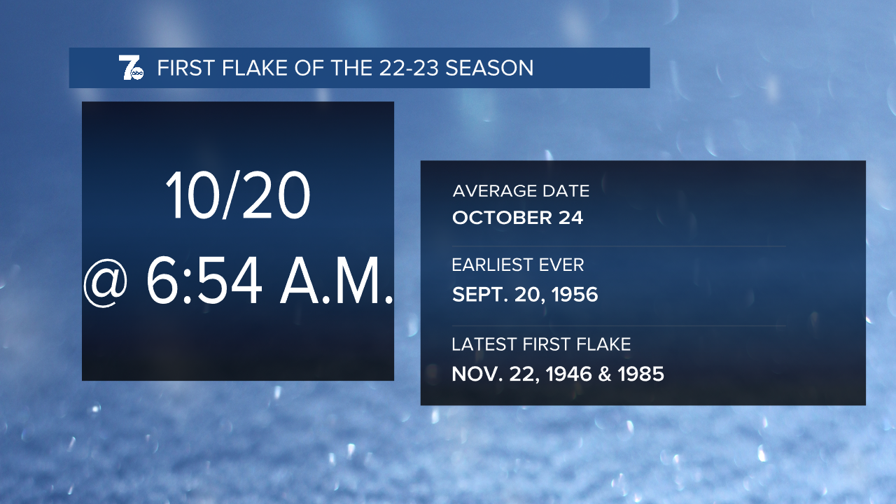
Onto the 2022-2023 season, the first flakes have fallen four days before average on October 20th.

The first measurable snowfall typically happens November 8th and the 1st inch comes mid-November. November 13th, 2021 is when the 1st inch of snow fell at the Buffalo Airport last year. The 1st inch of snow fell on December 1st, 2020, the year before.
The first inch of snow won't happen this week as temperatures are expected to stay above normal through the middle of November. Expect this winter season to start slowly as the Hemispheric pattern won't be conducive for prolonged cold and snowy weather as we end 2022.
Like last year, when we head into January we expect to see more of an impact from the Polar Vortex. As colder air surges from the North Pole to Western New York, we'll see colder air for January and more snowfall.
Last year, we did not see much in the way of major lake effect snow events, and we expect that again this year. Local ski resorts will need to plan carefully as snow making will be hit or miss just like last season.
Our last day of snow was on April 27 with 1.4" of snow recorded that day. We have had 139 straight years of snow in April and expect that streak to continue for 2023.
This year we expect slightly below normal snow amounts with fewer impactful lake effect snow events. Temperatures are forecast to be slightly above normal.
