
BUFFALO, N.Y. (WKBW) — Wintry weather returns to Western New York!
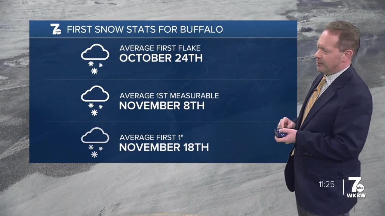
Buffalo recorded its first measurable snowfall on Sunday, amounting to 0.9" as of 4 p.m. Snow continued to fall intermittently and lightly into the night.
By far, this is the coldest air of the season to date. Highs on Monday will be in the low to mid-30s. The wind-chill will be in the 20s!
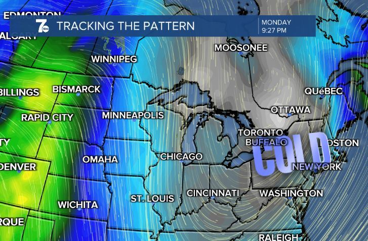
Snow showers are likely across all of Western New York on Monday.

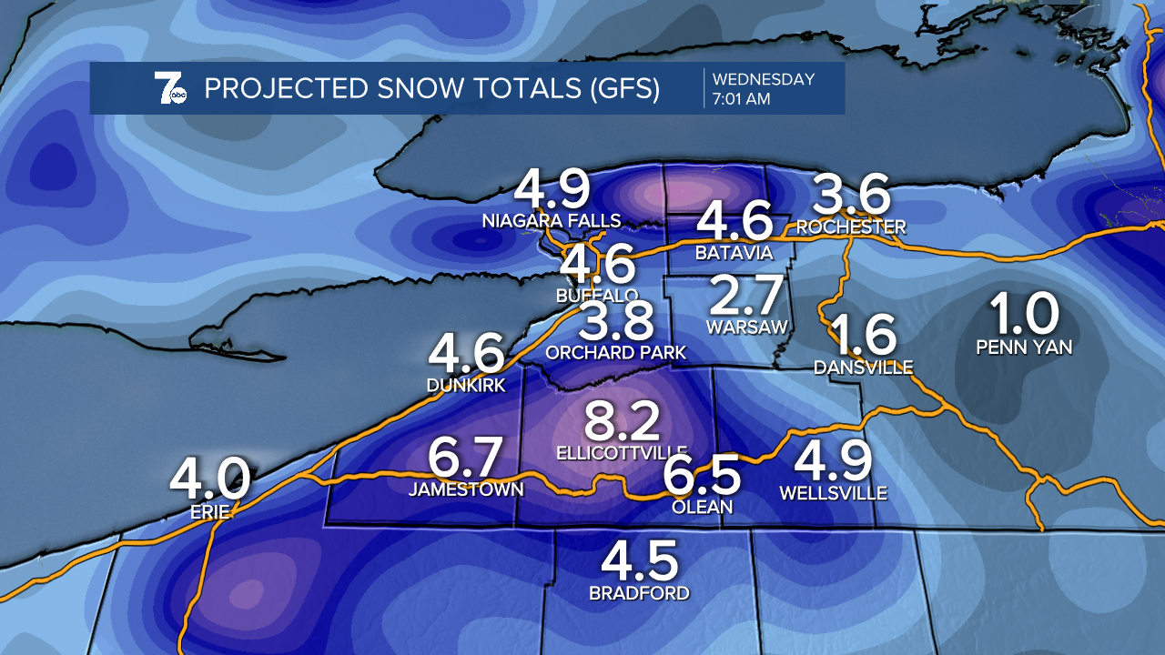
The morning commute on Monday will be a snowy one. The ground is still quite warm, so expect most of the snow in Buffalo to melt on contact with the pavement. Higher accumulations are possible across the higher elevations of the Southern Tier.
Lake Erie is 54 degrees Fahrenheit and the air at 5,000 feet will be in the 10 to 15 degrees Fahrenheit range. This colder air over Lake Erie will produce lake effect snow on Monday. Winds will be northwesterly, which will help in producing lake-enhanced and lake effect snow showers south of Buffalo on Monday and Tuesday. The air temperature aloft and the Lake Erie temperature difference is a huge factor in the formation of lake effect snow. This large temperature difference could increase the lake effect intensity.
By Tuesday morning, an inch or two of snow is possible in Buffalo. A few inches of snow will accumulate over the higher elevations south of Buffalo, especially along the Chautauqua Ridge. This is fairly typical for early season lake effect snow events, whereby how much snowfall you see is a function of elevation.
You can watch our preliminary forecast below. These numbers can change, so stick with the 7 Weather team for the latest!