
Winter Storm Warning in effect now through 7pm Monday for Northern Erie, Niagara, Genesee, and Orleans Counties.
Winter Storm Warning in effect now through 7pm Monday for Southern Erie, Wyoming, Chautauqua, Cattaraugus, and Allegany Counties.
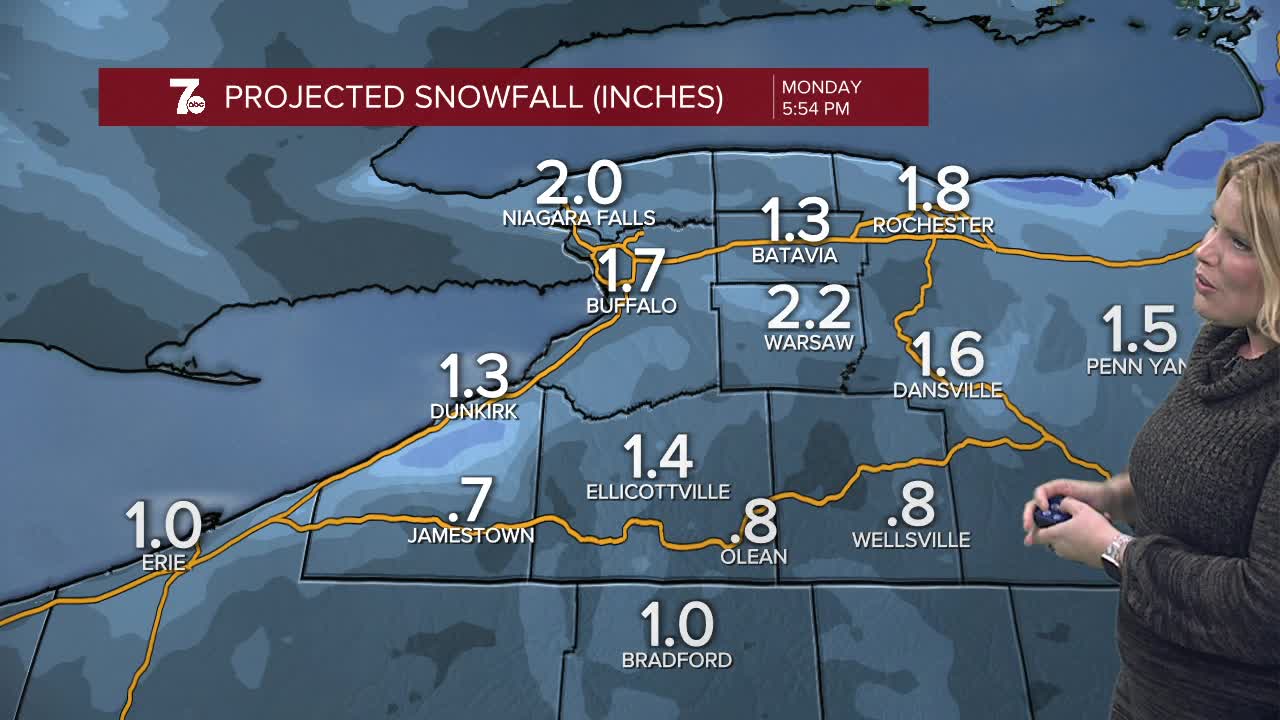
Snow will be less widespread and more lake enhanced off of the southern shore of lake Ontario and along the higher elevations south of Buffalo into the overnight with minor accumulations through the morning.
Snow is more localized on Monday with lake effect both north and south of Buffalo. Lake Ontario lake effect snow will be more organized and deliver higher snowfall on Monday than lake snow off of Lake Erie southeast of Buffalo.
MONDAY
MORNING: Snow showers, near 10.
AFTERNOON: Snow showers, 15.
TUESDAY
MORNING: Snow showers, 5.
AFTERNOON: Snow showers, blowing snow 15.
WEDNESDAY
MORNING: Very Cold, near 7.
AFTERNOON: Lake snow, 15.
THURSDAY
MORNING: Very Cold. Lake Snow showers, 6.
AFTERNOON: Lake Snow showers, 10.
FRIDAY
MORNING: Cold, scattered snow showers. 1.
AFTERNOON: Lake Snow showers, 14.
