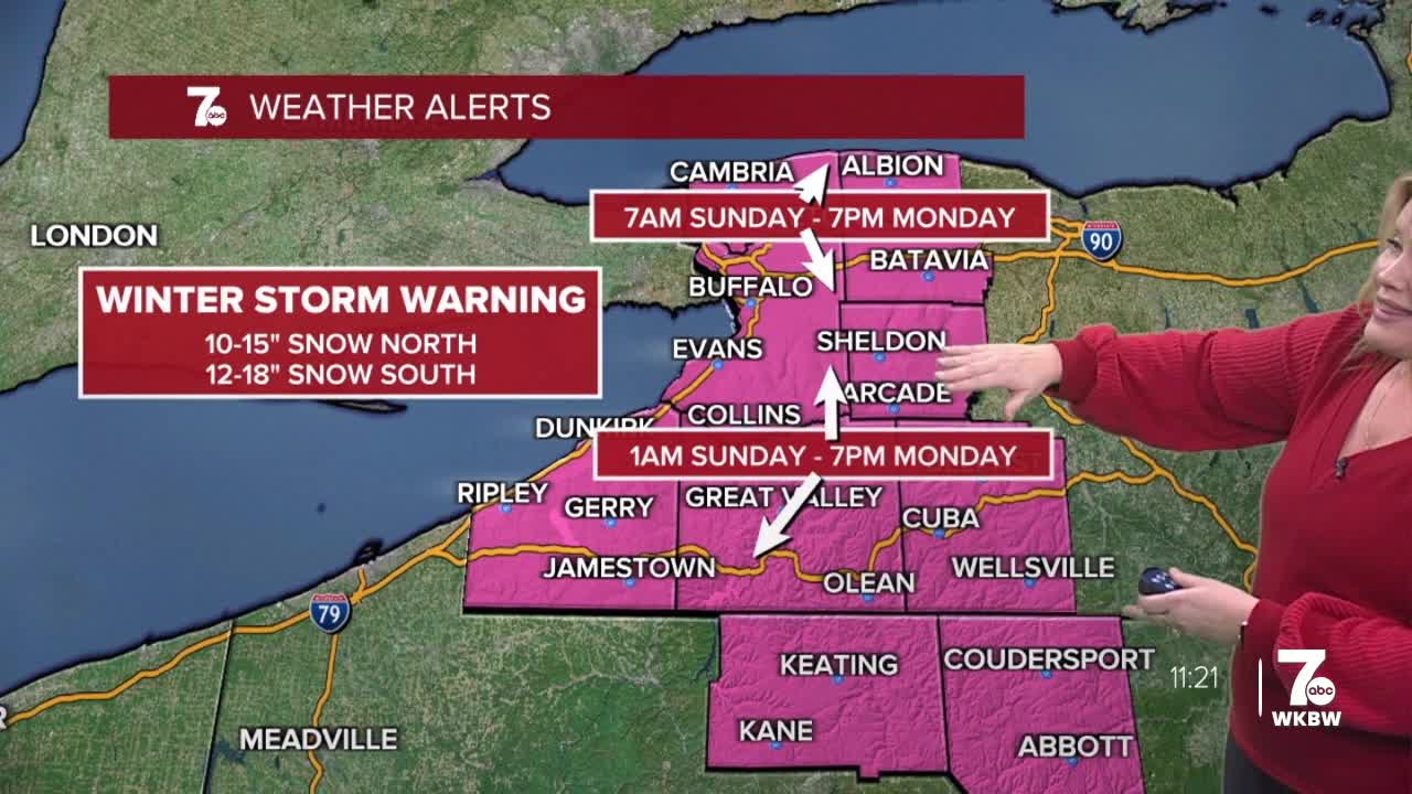

Winter Storm Warning from 7am Sunday to 7pm Monday for Northern Erie, Niagara, Genesee, and Orleans Counties for heavy snow. 8 to 14 inches of snow possible by late Monday.
Winter Storm Warning from 1am Sunday through 7pm Monday for Southern Erie, Wyoming, Chautauqua, Cattaraugus, and Allegany Counties for 8 to 14 inches of snow by late Monday.
Autumn Lewandowski was live on Facebook showing the latest forecast for the winter storm and answering your questions here
Saturday night is quiet and cold under mostly cloudy skies. A major storm system will approach the area on Sunday bringing a general snow to the region. The snow could be heavy at times starting across the S.Tier and moving northward across WNY. Most significant snow falls through late Sunday evening. Snow is more localized on Monday with lake effect.
WHAT TO EXPECT SUNDAY:
MORNING:
Light snow showers arrive from south to north across WNY Sunday morning with only 1-2" through noon for Buffalo. 2-4" south.
AFTERNOON: After noon, snowfall will be heavier, near an inch an hour and likely accumulating 8-10" through the evening.
OVERNIGHT:
Snow will be less widespread and more lake enhanced off of the southern shore of lake Ontario and along the higher elevations south of Buffalo.
SUNDAY
MORNING: Snow arrives, 3.
AFTERNOON: Snow, near 10.
MONDAY
MORNING: Snow, near 10.
AFTERNOON: Snow showers, 15.
TUESDAY
MORNING: Snow showers, 5.
AFTERNOON: Snow showers, 15.
