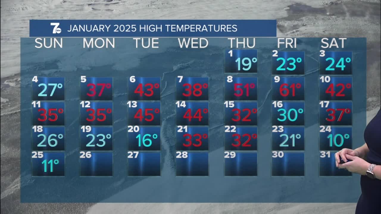

BUFFALO, N.Y. (WKBW) — Limited lake snow showers into the overnight with minor accumulations of 1-2" possible. Cold conditions with lows in the single digits and wind chills remaining below zero.
Winds shift to the northwest on Thursday bringing lake effect snow showers across Ski Country and the southern shore of Lake Ontario. Only minor accumulations are expected with chilly highs in the low teens and wind chills below zero.
Colder air seeps in during the afternoon and continues into Friday with lows below zero and wind-chill values near -15. Highs on Friday struggle to get out of the single digits with wind-chills remaining below zero.
The weekend will round out high temperatures below 20 degrees. However, we're firmly trapped in below average temperatures to start February with highs in the 20s.
THURSDAY
MORNING: Snow showers, near 5.
AFTERNOON: Cold, 13.
FRIDAY
MORNING: Frigid, -4.
AFTERNOON: Cold, near 10.
SATURDAY
MORNING: Mostly cloudy, 5.
AFTERNOON: Mostly cloudy, 13
SUNDAY
MORNING: Mostly cloudy, 5.
AFTERNOON: Mostly cloudy, 15.
