
Flood Watch for all of WNY through 8pm Wednesday.
Flood Warning until Wednesday afternoon for Cazenovia Creek near Cazenovia Creek at Ebenezer.
Flood Warning for Cattaraugus Creek at Gowanda until Wednesday morning.
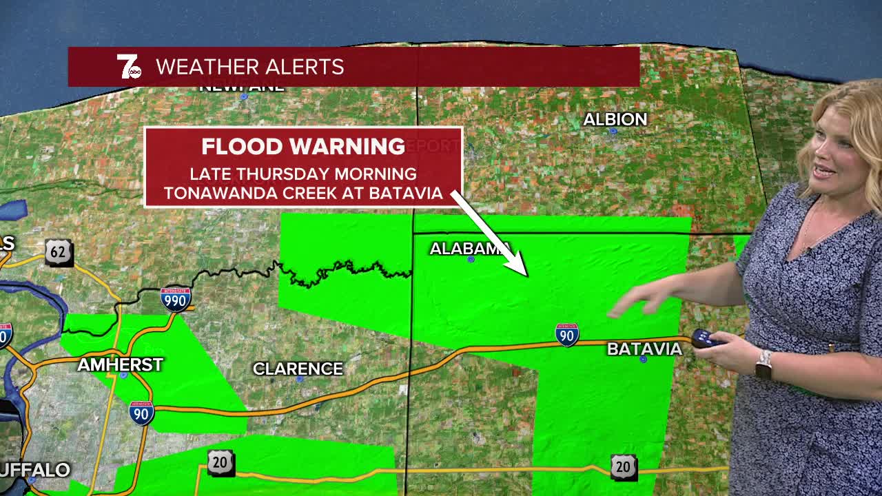
Flood Warning until 12pm Wednesday for Tonawanda Creek at Batavia and Attica.
Flood Warning until Wednesday afternoon for Cayuga Creek near Lancaster.
Flood Warning until Wednesday evening for Buffalo Creek at Gardenville.
Flood Warning from Wednesday afternoon through Late Thursday morning, Ellicott Creek near Williamsville.
Flood Warning until 12:15am for a portion of Erie and Wyoming county.
Flash Flood Warning until 12am Wednesday for northern Allegany county.
1.5"-2.5" of rain have fallen across WNY with some localized higher amounts, leaving flooding of low lying areas and poor drainage locations under water. Many creeks and streams and rivers are running high, near flood stage or have overflowed their banks across WNY. Multiple Flood Warnings remain in place Tuesday night as temperatures drop and cooler air settles in Wednesday.
Showers remain in place mainly across the S.Tier Wednesday. Temperatures increase on Thursday and continue to rise into Friday and Saturday with chances of showers each day. Easter Sunday will transition to a cooler airmass, beginning with rain showers.
WEDNESDAY
MORNING: Showers, near 40.
AFTERNOON: Cloudy skies, mid 40s.
THURSDAY
MORNING: Mostly cloudy, mid 30s.
AFTERNOON: Showers, near 60.
FRIDAY
MORNING: Showers, mid 50s.
AFTERNOON: Mostly cloudy, mid 60s.
SATURDAY
MORNING: Mostly cloudy, low 40s.
AFTERNOON: Showers, upper 60s.
