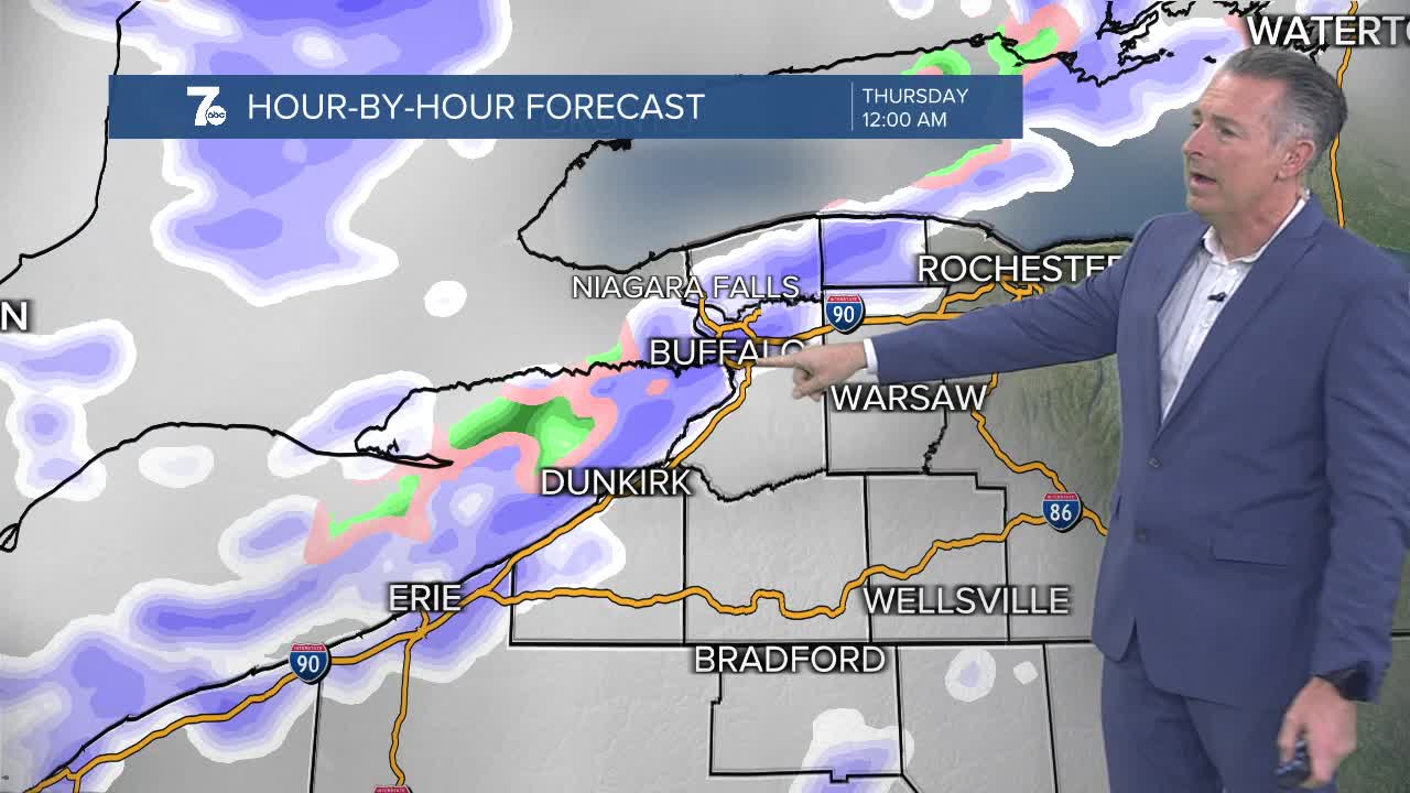

Lake Effect Snow Warning from 1am Thursday through 1am Saturday for Southern Erie, Wyoming, Chautauqua, and Cattaraugus Counties. Strong winds with 12 to 20 inches of snow expected.
Winter Weather Advisory from 9pm Wednesday through 1pm Thursday for Northern Erie and Genesee Counties. Strong winds with 2 to 5 inches of snow expected.
Winter Weather Advisory from 7pm Wednesday through 7am Thursday for Niagara and Orleans Counties. Strong winds with 2 to 4 inches of snow expected.
Low pressure will bring rain to the area today. The rain will start south of Buffalo and spread northward. Expect rain in Buffalo close to 12pm. Rain showers will continue overnight with temperatures holding steady near 50 degrees.
A strong cold front will move through WNY Wednesday afternoon and temperatures will drop into the 30s. The rain will change to snow and winds will gust near 50 miles per hour. Lake effect snow will then develop off of Lake Erie and be near Buffalo through Thursday morning. The band will then shift south on Thanksgiving.
TUESDAY
AFTERNOON: Rain likely, low 50s.
WEDNESDAY
MORNING: Rain showers, near 50.
AFTERNOON: Rain to snow, upper 30s.
THURSDAY
MORNING: Snow, near 30.
AFTERNOON: Snow and strong winds, mid 30s.
FRIDAY
MORNING: Snow, upper 20s.
AFTERNOON: Snow, low 30s.
SATURDAY
MORNING: Flurries, mid 20s.
AFTERNOON: Mostly cloudy, low 30s.
