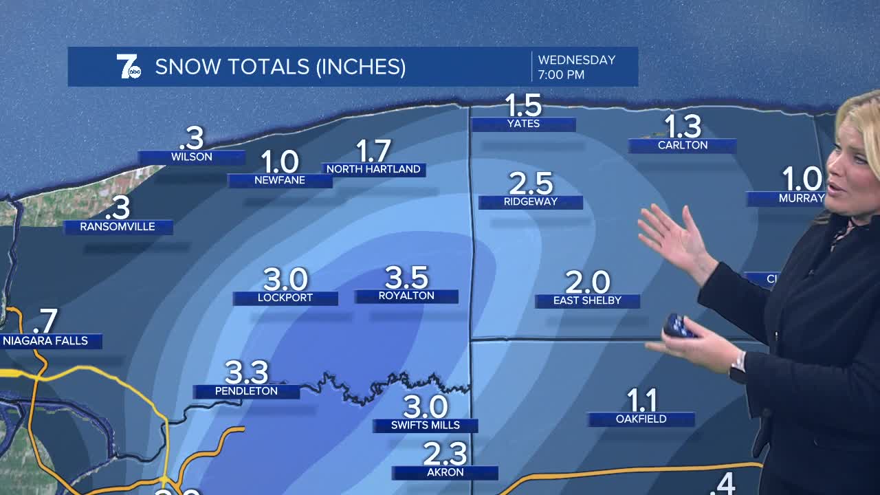

Winter Weather Advisory for Northern Erie, Niagara, and Orleans Counties until 10am Wednesday for 2 to 5 inches of snow.
The lake band strengthens overnight and focus on Buffalo. At onset there could be rain mixing in near the lake shore to limit accumulations, then into the overnight it gets cold enough for all snow. And inland, in the most persistent portion of the band which remains snow, you can expect 3-5" of accumulation. Expect snow early Wednesday morning to change to rain as the morning moves along and the band shifts a bit south as temperatures warm up to near 40. The last areas to see the switch to rain will be the hill tops east and south of Buffalo for Wednesday afternoon.
OVERNIGHT: Lake band over or just north of downtown Buffalo, inland to Lockport. Will shift back south to Buffalo and eastern suburbs by the morning drive as snow switches to rain.
WEDNESDAY
MORNING: Snow, near 30.
AFTERNOON: Rain and snow, near 40.
THURSDAY
MORNING: Mostly cloudy, low 30s.
AFTERNOON: Few showers, mid 40s.
FRIDAY
MORNING: Mostly cloudy, low 30s.
AFTERNOON: Mostly cloudy, upper 40s.
SATURDAY
MORNING: Mostly cloudy, mid 30s.
AFTERNOON: Mostly cloudy, upper 40s.
