
Winter Weather Advisory in effect from Friday 7am through Saturday 7pm. 3-6" of snow possible with 40mph wind gusts creating blowing and drifting snow. Counties include, Niagara, Erie, Orleans, Genesee, Wyoming and Chautauqua and Cattaraugus.
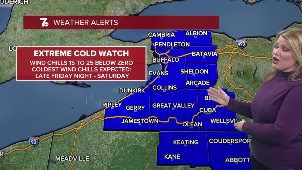
Extreme Cold Watch from 1am Saturday through 10am Sunday. Wind-chills will be -25 on Saturday.
Mostly cloudy skies this afternoon. Snow returns on Friday with 1-2" of snow by Friday evening. Extreme cold arrives Saturday with temperatures in the single digits and wind-chills -20 to -30 degrees. Frostbite can occur in 15 minutes.
FRIDAY MORNING: Mostly cloudy and cold, temperatures in the teens with fairly light winds.
FRIDAY AFTERNOON: Snow showers 1-2" by the dinner hour, winds begin to gust around 20mph from noon, onward. Temps in the upper 20s.
FRIDAY EVENING: Snow showers continue. Winds gust to 25mph, temperatures begin to drop.
FRIDAY MIDNIGHT - MORNING: Bursts of snow showers, Winds gusting over 30mph and temperatures plummeting to near zero.
SATURDAY MORNING: Lake snow showers. Blustery near zero temps, wind chills down to -20 degrees and winds gusting over 25mph.
SATURDAY AFTERNOON/EVENING: Lake effect snow. Cold and dangerous wind chills. Single digit temps, wind chills -15 to -25.
FRIDAY
MORNING: Snow arrives, 15.
AFTERNOON: Snow showers, mid 20s.
SATURDAY
MORNING: Snow showers, -2.
AFTERNOON: Cold wind, 6.
SUNDAY
MORNING: Mostly cloudy, -1.
AFTERNOON: Mostly cloudy, 13.
MONDAY
MORNING: Mostly cloudy, 10.
AFTERNOON: Mostly cloudy, near 20.
