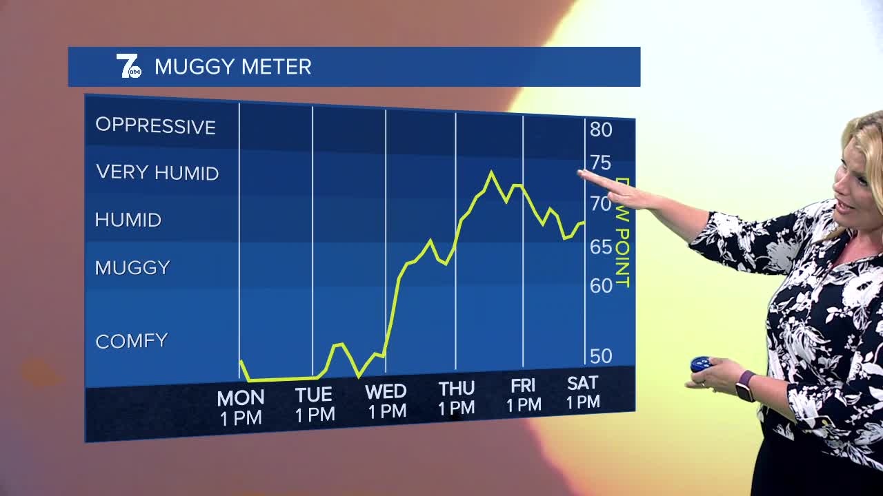

BUFFALO, N.Y. (WKBW) — Open the windows and let the fresh cool air in! It will be clear and cool tonight with lows in the 40s across the Southern Tier with the mid-50s for Buffalo. Tuesday starts cool but temperatures get closer to normal with highs near 80. At least there won't be much humidity accompanying the seasonable temperatures. However that doesn't last long. The heat will ramp up under an area of high-pressure Wednesday as highs rise into the mid-upper 80s and likely into the low 90s on Thursday with much more humidity. The record high on Thursday is 91 degrees set in 1945 and the Buffalo Airport has a very good chance at tying that!
TUESDAY
MORNING: Mainly clear and cool, mid 50s.
AFTERNOON: Mostly sunny, upper 70s.
WEDNESDAY
MORNING: Mostly clear, near 60.
AFTERNOON: Mostly sunny, mid 80s.
THURSDAY
MORNING: Partly cloudy, low 70s.
AFTERNOON: Hot and humid, low 90s.
FRIDAY
MORNING: Partly cloudy, mid 70s.
AFTERNOON: Sctd. storms, mid 80s.
