
Winter Storm Warning through Wednesday afternoon for Erie, Genesee, Wyoming, Chautauqua, and Cattaraugus Counties. Snowfall rates of 2-3" per hour, winds gusting between 35-50mph will create blowing and drifting snow and whiteout conditions at times within lake snow.
Cold Weather Advisory 10pm today through 1pm for Wyoming, Chautauqua, Cattaraugus, and Allegany Counties for wind-chills near 20 degrees below zero.
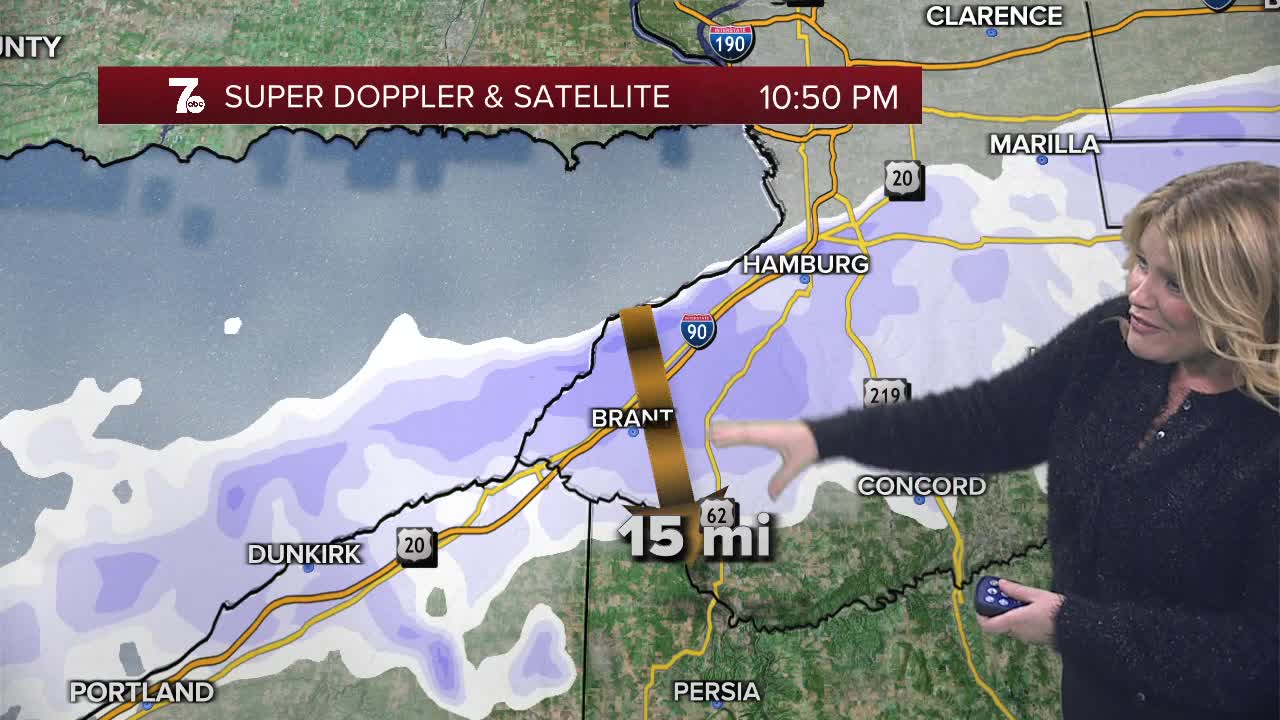
Lake effect snow organized south of Buffalo across the southtowns. Expect 18-24" in most persistent of the part band. Strong winds creating blowing and drifting snow and below zero wind chills.
Tonight and through Tuesday afternoon the band will be south of Buffalo with localized areas of 2-3 feet of snow accumulating in the Southtowns likely from Eden, to Hamburg to Orchard Park. The band shifts north again Tuesday night while becoming weaker.
It'll be cold Tuesday with highs in the teens and wind chills well below zero. Be prepared for various road conditions from strong gusts winds, creating blowing and drifting snow to near whiteouts within lake effect snow.
OVERNIGHT: Snow south of Buffalo 18-24" southtowns and Boston Hills. Wind chills below zero.
TUESDAY
MORNING: Snow south, 7.
AFTERNOON: Snow south, low teens.
WEDNESDAY
MORNING: Snow showers, near 10.
AFTERNOON: Snow showers, near 30.
THURSDAY
MORNING: Snow showers, near 20.
AFTERNOON: Snow showers, upper 20s.
FRIDAY
MORNING: Snow showers, near 10.
AFTERNOON: Snow showers, near 15.
