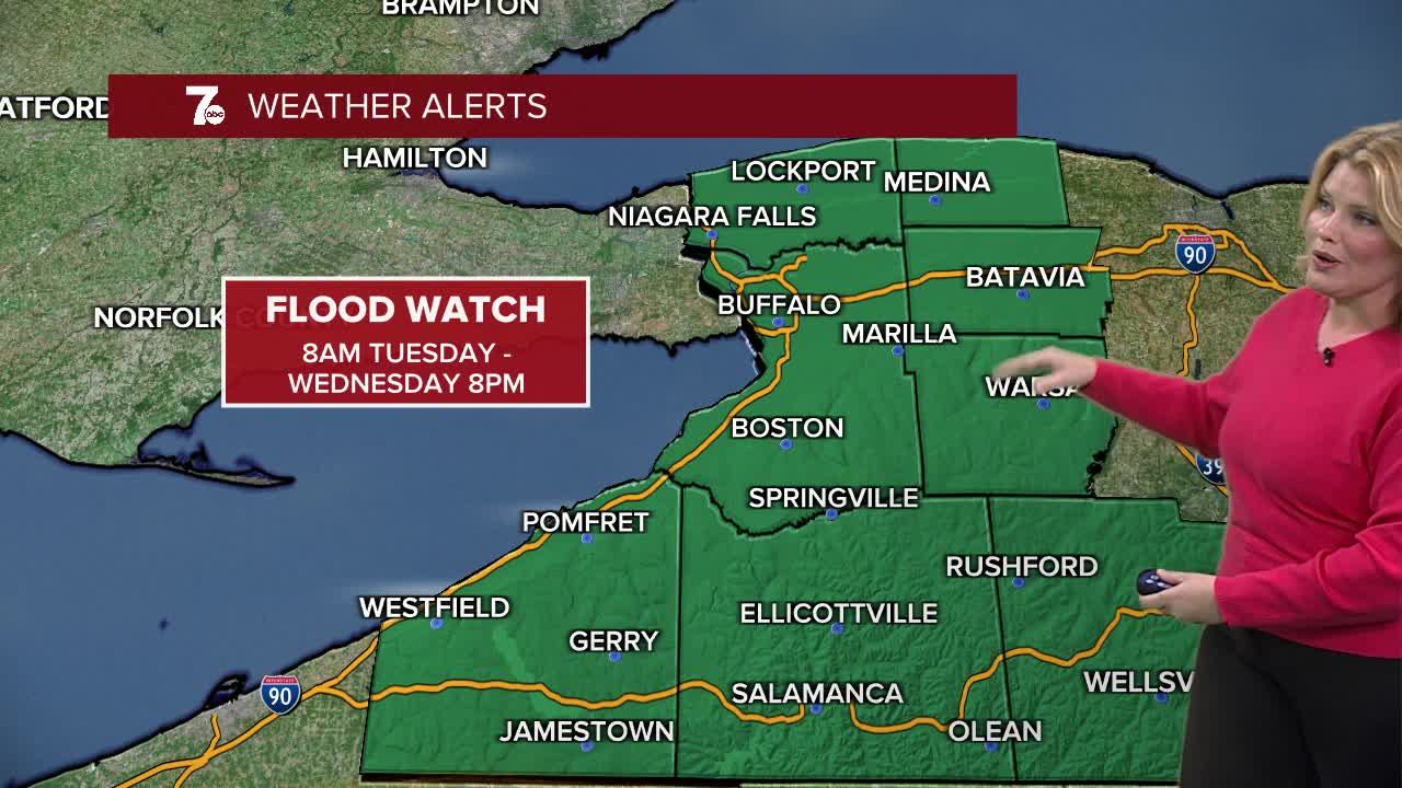

FLOOD WATCH Tuesday morning through Wednesday evening for all of WNY. Multiple rounds of showers and t-storms are expected which may result in several inches of rain. Excess runoff may cause streams and creeks to reach or exceed flood stage. General flooding is possible especially in low-lying and poor drainage areas.
Showers and thundershowers expected overnight with lows near 50. Thunderstorms will develop on Tuesday with strong to severe storms possible. Isolated tornadoes are possible Tuesday afternoon and evening. Conditions remain unsettled with rain chances into the middle of the week with cooler temperatures.
OVERNIGHT: Scattered showers & T-Storms. Near 50
TUESDAY
MORNING: Showers and t-showers, near 50.
AFTERNOON: T-storms, upper 60s.
WEDNESDAY
MORNING: Showers, low 40s.
AFTERNOON: Showers, upper 40s.
THURSDAY
MORNING: Showers, mid 30s.
AFTERNOON: Mostly cloudy, mid 50s.
FRIDAY
MORNING: Showers, upper 40s.
AFTERNOON: Showers, mid 60s.
