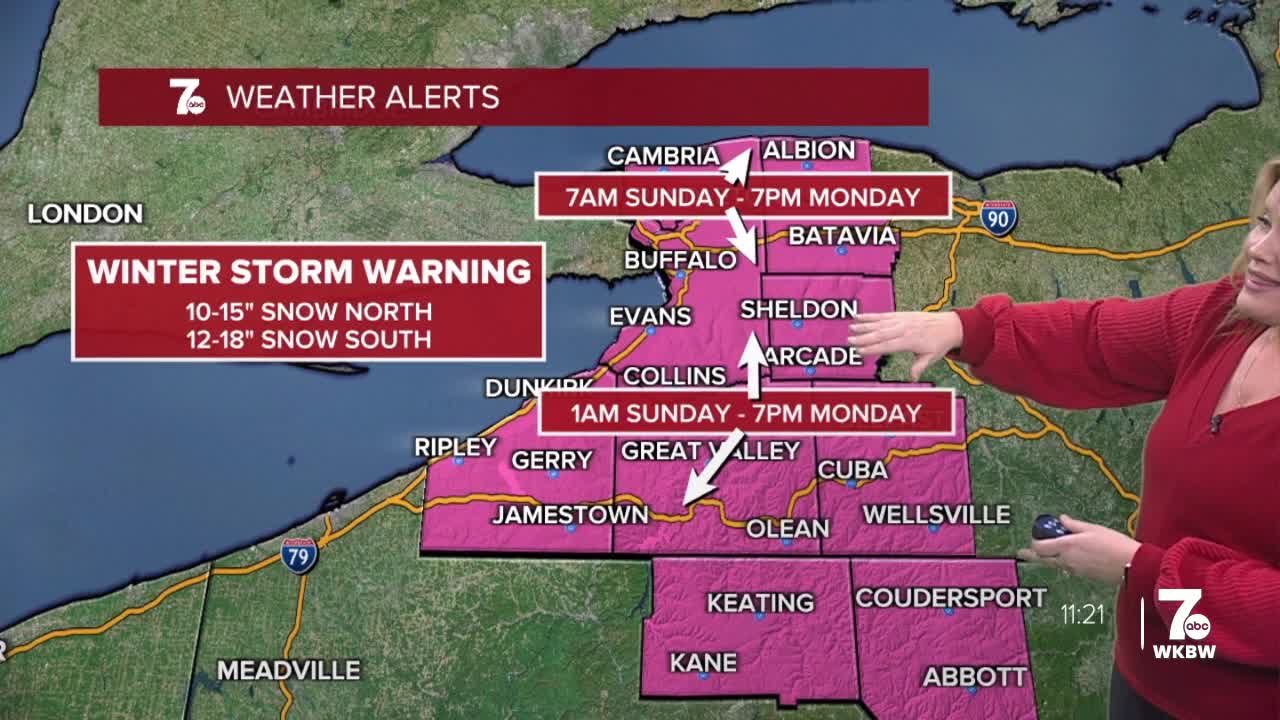

Winter Storm Warning from 7am Sunday to 7pm Monday for Northern Erie, Niagara, Genesee, and Orleans Counties for heavy snow. 10 to 15 inches of snow possible by late Monday.
Winter Storm Warning from 1am Sunday through 7pm Monday for Southern Erie, Wyoming, Chautauqua, Cattaraugus, and Allegany Counties for 12 to 18 inches of snow by late Monday.
Cold Weather Advisory 10am today through 10am Saturday for all of Western New York for wind-chills -15 to -25.
Winter Weather Advisory for Orleans County 3pm today through 10am Saturday for a few inches of snow.
Lake effect snow showers will continue north of Buffalo. 1 to 3" of accumulation combined with strong winds will create areas of blowing snow.
A few early flakes hanging along the lake Ontario shoreline Saturday morning while temperatures start below zero and wind chills that are well below zero. Partly sunny and cold Saturday afternoon with highs in the single digits. Wind chills will remain below zero for the day. Saturday night is quiet and cold under mostly cloudy skies. A major storm system will approach the area on Sunday bringing a general snow to the region. The snow could be heavy at times starting across the S.Tier and moving northward across WNY. Most significant snow falls through late Sunday evening. Snow is more localized on Monday with lake effect.
SATURDAY
MORNING: Flurries, -2.
AFTERNOON: Frigid, 9.
SUNDAY
MORNING: Snow arrives, 3.
AFTERNOON: Snow, near 10.
MONDAY
MORNING: Snow, near 10.
AFTERNOON: Snow showers, 15.
TUESDAY
MORNING: Snow showers, 5.
AFTERNOON: Snow showers, 15.
