
Winter Weather Advisory until 7pm Saturday for Erie, Niagara, Orleans, Genesee, Wyoming, Chautauqua, and Cattaraugus Counties. 2 to 4 inches of snow with blowing snow expected.
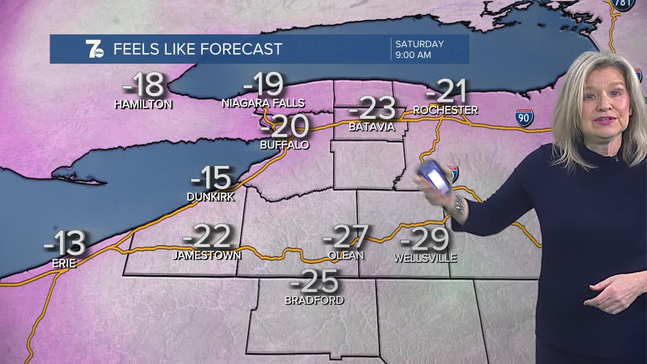
Extreme Cold Warning 1am Saturday through 10am Sunday for Southern Erie, Wyoming, Chautauqua, and Cattaraugus Counties. Wind-chills -30 degrees.
Extreme Cold Advisory 1am Saturday through 10am Sunday for Northern Erie, Niagara, Orleans, and Genesee Counties. Wind-chills -15 to -25 degrees.
An arctic cold front will allow temperatures to drop to near 0 by Saturday morning. Temperatures will hold in the single digits on Saturday with wind-chills -15 to -30 degrees. It won't be much warmer on Sunday with highs again in the single digits and wind chills averaging below zero. Limit time outdoors.
HERE'S THE BREAKDOWN:
FRIDAY MIDNIGHT - MORNING: Bursts of snow showers, Winds gusting over 30mph and temperatures plummeting below zero and wind chills to -30 degrees.
SATURDAY MORNING: Lake snow showers. Blustery near zero temps, wind chills down to -30 degrees and winds gusting over 25mph.
SATURDAY AFTERNOON/EVENING: Lake effect snow. Cold and dangerous wind chills. Single digit temps, wind chills -15 to -25.
SATURDAY
MORNING: Snow showers, near 0.
AFTERNOON: Frigid, 7.
SUNDAY
MORNING: Mostly cloudy, near 0.
AFTERNOON: Mostly cloudy, near 10.
MONDAY
MORNING: Mostly cloudy, near 10.
AFTERNOON: Mostly cloudy, near 20.
TUESDAY
MORNING: Flurries, 15.
AFTERNOON: Mostly cloudy, near 30.
