
Lake effect snow Warning until 1 a.m. Saturday for Southern Erie, Wyoming, Chautauqua, Cattaraugus, and Allegany Counties.
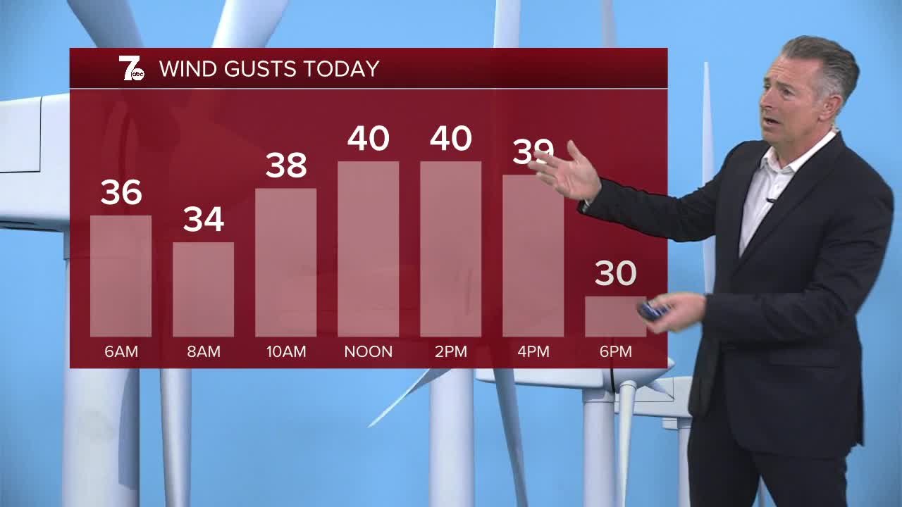
Lake effect snow will continue south of Buffalo. Several more inches of snow expected in the lake bands. Outside of the lake effect expect scattered snow showers with a Trace to 2" of accumulation. Winds will gust near 40 miles per hour again today. The snow will taper off tonight with quiet weather for your Saturday.
Another area of low pressure arrives on Sunday with rain and snow across the area.
FRIDAY
MORNING: Lake effect south, near 30.
AFTERNOON: Breezy with snow showers, mid 30s.
SATURDAY
MORNING: Mostly cloudy, mid 20s.
AFTERNOON: Mostly cloudy, low 30s.
SUNDAY
MORNING: Snow showers, near 30.
AFTERNOON: Rain and snow, upper 30s.
MONDAY
MORNING: Mostly cloudy, mid 20s.
AFTERNOON: Mostly cloudy, low 30s.
TUESDAY
MORNING: Snow showers, mid 20s.
AFTERNOON: Snow showers, low 30s.
